

Survey Solution In Delhi
(47 products)
Survey Programming
Software PackagesConfirmIt SPSS
Programming LanguagesMultiple
Data SecurityAES-256
Reporting OptionsCustomizable
Survey TypesOnline mobile
UsageOnline survey creation and data analysis for market research customer feedback and employee surveys.

Build Survey
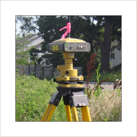
Survey TypeAs-built
MethodologySite survey
Data CaptureDigital
DeliveryDigital files
FormatCAD drawings
AccuracySub-meter

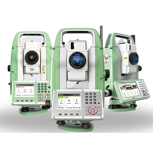
Surveying Solutions - Color: Green And White
MOQ1 Piece/Pieces
Operate MethodAutomatic
UsageSurvey
ColorGreen And White
Product TypeSURVEYING SOLUTIONS
K. K. Sales
SG Highway, Ahmedabad
 Trusted Seller
4 Years
Levelling Survey Services
MOQ1 Unit/Units
Control TypeManual & Electronic
AccuracyUp to 2 mm/km
Temperature ResistanceOperational range -10C to 50C
FeaturesHigh Precision Fast Data Processing Real-Time Data Output Reliable in Harsh Conditions
Display TypeDigital/Analog (as per equipment)
ShapeEquipment in Compact and Portable Form
Alpha Engineering Equipments
Nagpur
Trusted Seller1 Years

Home Survey Services
Equipment TypeLaser scanner
Primary ColorYellow
AccuracySub-millimeter
Range100m
Data OutputDigital
SoftwareProprietary
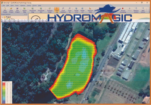
Bathymetric Survey Software Application: Networking
Software TypeHydrographic
Primary FunctionDepth mapping
Supported SensorsMultiple types
Data OutputVarious formats
Operating SystemWindows based
InterfaceUser-friendly GUI
Geonav Survey Solutions
Nerul, Navi Mumbai
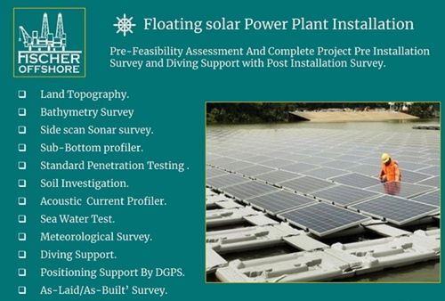
Red Floating Solar Power Plant Survey Services
MethodologySurvey methods
EquipmentDGPS Sonar
DeliverablesReports data
AccuracyHigh precision
ComplianceIndustry standards
UsageFloating solar plant surveys pre and post-installation including diving support
Fischer Marine And Offshore Private Limited
Navi Mumbai
Fruits and Vegetables Surveys Service
Service TypeSurveys
IndustryAgriculture
Geographic CoverageGlobal
Report DeliveryReal-time
MethodologyOn-site
Report FormatApp

Highway Survey Solutions
Data Acquisition3D Laser Scanning
Point DensityHigh Density
Data FormatXYZ LAS
AccuracySub-centimeter
DeliveryCAD File
SoftwareCompatible
Dgps Survey Services - Pan India Offline Service Flexible Duration & Payment Options Available
Service TypeDGPS Survey
AccuracyCentimeter-level
Data FormatRTCM
Coverage AreaPan-India
Service ModeOffline/Online
Payment ModeOnline/Offline
Route Survey Services - Pan India Coverage 0-3 Months Duration Offline Methodology
Survey TypeRoute Survey
Service AreaPan India
Duration0-3 months
ModeOffline
AccuracyHigh Precision
TechnologyTotal Station

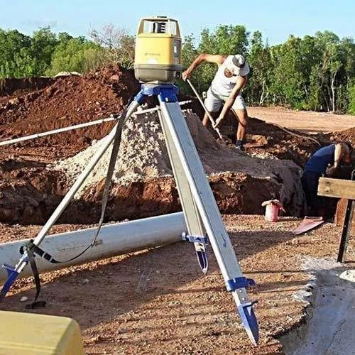
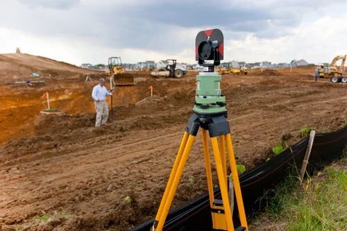
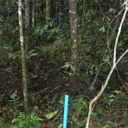
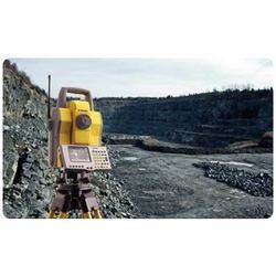
Site Survey
Product TypeSite Survey
Dominant ColorYellow
AccuracyHigh Precision
ResolutionSub-meter
RangeLong Distance
MaterialsMetal Plastic
FAQs Related to Survey Solution In Delhi
How many survey solution products are available in Delhi?
Where can I find survey solution nearby Delhi?
What are some related categories to survey solution in Delhi?
Can I trust the Delhi Based Survey Solution suppliers listed on Tradeindia?
How many Delhi based Survey Solution manufacturers are there?
What is the price range of survey solution in Delhi?
| Company Name | Currency | Product Name | Price |
|---|---|---|---|
| - | - | Bathymetric Survey Software | 200000 INR (Approx.) |
| - | - | Floating Solar Power Plant Survey Services | 90000 INR (Approx.) |
What is the delivery time for survey solution in Delhi?
How many trusted sellers are available for Survey Solution in Delhi?
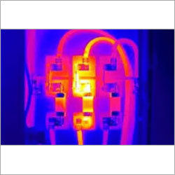
Thermography Survey Solution
Camera TypeInfrared
ResolutionVariable
Temperature Range-20°C to 300°C
Image FormatDigital
Report FormatPDF
CertificationCertified Thermographer
Statistical Analysis Surveys Software Solution
Software TypeStatistical
Data InputSurvey data
Output FormatReports charts
CustomizationClient-specific
AccuracyHigh
DeliveryOn-time

Qualitative Surveys
MethodologyQualitative
Survey TypeVarious
Data AnalysisDescriptive
Sample SizeVariable
Report FormatCustomizable
Delivery TimeProject-specific
Tbcs Research
New Delhi

High Transmission Line Survey
MethodologyGIS-based
AccuracySub-meter
SoftwareAutoCAD
DeliverablesDigital Maps
ComplianceIEC 61850
Coverage AreaVariable
Dhyani Consultants Inc.
New Delhi
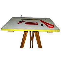
Plane Table Survey - Advanced Technology Equipment Accurate Topographical Mapping and Efficient Service
Table MaterialWood
Surface MaterialLaminate
DimensionsVariable
Weight10kg
AccessoriesIncluded
UsageLand surveying mapping and topographical detail creation for architects real estate developers and civil engineers.
Dhyani Consultants Inc.
New Delhi
Demarcation Survey
MethodologyGPS/GIS
AccuracySub-meter
Delivery Time2-4 weeks
Report FormatDigital/Print
Data SourcesGPS Survey
UsageReal estate & civil construction boundary demarcation
Dhyani Consultants Inc.
New Delhi
Route Survey - Precision Measurement Services | Custom Designed for Highways Pipelines Canals Railroads
MethodologyGPS/GIS
Data AccuracySub-meter
Data FormatDigital
Delivery Time2 weeks
SoftwareAutoCAD
UsageHighway pipeline canal railroad design
Dhyani Consultants Inc.
New Delhi
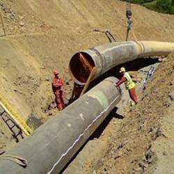
Pipeline Surveys - Comprehensive Survey Solutions for Pipeline Projects | Accurate Topographical Assessments As-Built Surveys Professional Expertise
MethodologyGPS/Total Station
Accuracy1cm RMS
DeliverablesDigital Maps
SoftwareAutoCAD/GIS
Scale1:500
UsagePipeline route surveying setting-out and as-built documentation.
Dhyani Consultants Inc.
New Delhi

Contour Survey - Advanced Elevation Mapping | Precision Soil Volume Calculation Expert Drainage Planning Efficient Irrigation & Sewer System Design
MethodologyTotal Station
AccuracySub-meter
ResolutionHigh
Delivery Time1-3 weeks
Data FormatDigital
EquipmentSophisticated
Dhyani Consultants Inc.
New Delhi
Topographical Survey - Robotic Instrumentation Laser & Infra-Red Measurement Technology Remote Data Capture
InstrumentationTrimble Series
TechnologyLaser/Infrared
AccuracySub-centimeter
Data CaptureElectronic
SoftwareSurvey Software
UsageCity Town Industrial Greenfield
Dhyani Consultants Inc.
New Delhi

Road Survey - High-Quality Pavement Condition Assessment | Fast Non-Intrusive Surveys Utility Mapping & Detailed Reporting Options
MethodologyTotal Station
AccuracySub-centimeter
Report FormatHardcopy/CD
Data Delivery24 hours
SoftwareAutoCAD
UsageRoad condition assessment utility mapping pavement sub-layer analysis void detection
Dhyani Consultants Inc.
New Delhi

GPS Surveys
Product TypeGPS System
AccuracySub-meter
Operating Temperature0-40°C
Antenna TypeGNSS
Data StorageInternal Memory
Power SourceBattery
Dhyani Consultants Inc.
New Delhi

Conventional Survey Services
MethodologyConventional
AccuracySub-meter
EquipmentLevel Theodolite
PersonnelCertified Surveyor
DeliverablesDigital maps
UsageLand surveying construction projects site planning infrastructure development and property boundary mapping.
General Engineering Works
Bharuch
Home Survey Services
Equipment TypeTotal Station
AccuracyMillimeter level
Range500m+
SoftwareSpecialized Survey
Data FormatVarious
UsageResidential property surveys site assessment boundary demarcation and construction layout
General Engineering Works
Bharuch

Service of Land Survey
MethodologyGPS Total Station
AccuracyCentimeter level
DeliverablesDigital maps reports
CoverageWide area
Turnaround Time7-10 days
UsageProperty boundary demarcation construction planning legal compliance.
Popular Categories in Delhi
Popular Products


© 1999-2026 Infocom Network Private Limited. All rights reserved.