

Survey Solution In Bharuch
(49 products)
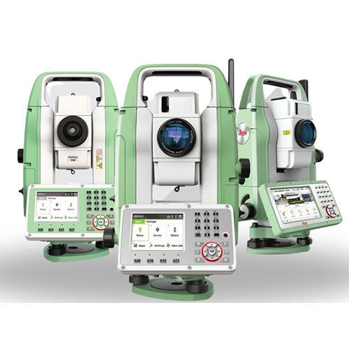
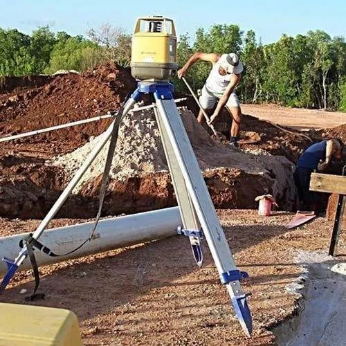
Home Survey Services
AccuracySub-millimeter
Data OutputDigital
Equipment TypeLaser scanner
FeaturesAccurate surveys Fast results Reliable service Expert staff Detailed reports Cost effective
Primary ColorYellow
Range100m

Surveying Solutions - Color: Green And White
MOQ1 Piece/Pieces
Operate MethodAutomatic
UsageSurvey
ColorGreen And White
Product TypeSURVEYING SOLUTIONS
K. K. Sales
SG Highway, Ahmedabad
 Trusted Seller
4 Years
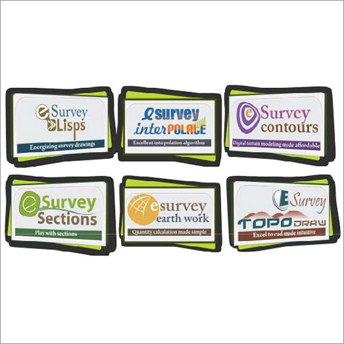
E Surveying Solutions
ColorBlack
Dimensions2x3 inches
FeaturesPrecise measurements Easy to use Durable cards Clear markings Multiple sections Professional quality
MaterialCard stock
PackagingBulk
Quantity6 cards
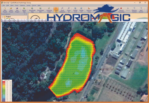
Bathymetric Survey Software Application: Networking
Data OutputVarious formats
FeaturesDepth mapping Dredge monitoring Affordable price Easy learning curve Wide sensor support
InterfaceUser-friendly GUI
Operating SystemWindows based
Primary FunctionDepth mapping
Software TypeHydrographic
Geonav Survey Solutions
Nerul, Navi Mumbai
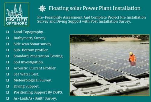
Red Floating Solar Power Plant Survey Services
AccuracyHigh precision
ComplianceIndustry standards
DeliverablesReports data
EquipmentDGPS Sonar
FeaturesSite surveys Pre-feasibility Post-installation Diving support Project support
MethodologySurvey methods
Fischer Marine And Offshore Private Limited
Navi Mumbai

Fruits and Vegetables Surveys Service
FeaturesQuality control Surveys Global reach Fast response Reliable reports
Geographic CoverageGlobal
IndustryAgriculture
MethodologyOn-site
Report DeliveryReal-time
Report FormatApp

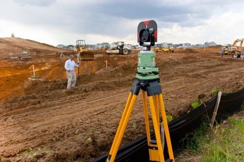
Highway Survey Solutions
AccuracySub-centimeter
Data Acquisition3D Laser Scanning
Data FormatXYZ LAS
DeliveryCAD File
Features3D Data Capture High Density Easy Import CAD File Output Professional Survey
Point DensityHigh Density
Levelling Survey Services
MOQ1 Unit/Units
FeaturesHigh Precision Fast Data Processing Real-Time Data Output Reliable in Harsh Conditions
Power SupplyBattery/Manual
Display TypeDigital/Analog (as per equipment)
Control TypeManual & Electronic
Temperature ResistanceOperational range -10C to 50C
AccuracyUp to 2 mm/km
Alpha Engineering Equipments
Nagpur
Trusted Seller1 Years
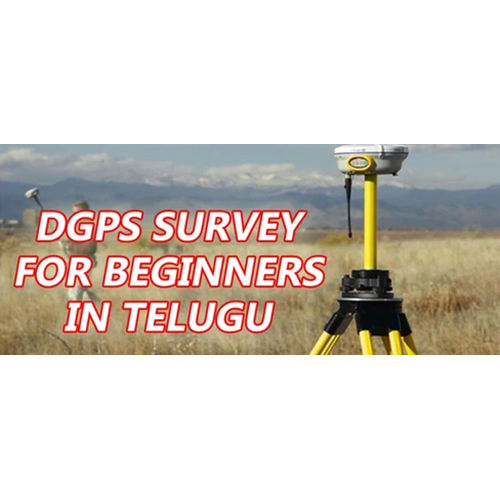
Dgps Survey Services - Pan India Offline Service Flexible Duration & Payment Options Available
AccuracyCentimeter-level
Coverage AreaPan-India
Data FormatRTCM
FeaturesHigh Accuracy Real-time Data Pan-India Coverage Reliable Service Offline/Online Modes
Payment ModeOnline/Offline
Service ModeOffline/Online
Route Survey Services - Pan India Coverage 0-3 Months Duration Offline Methodology
AccuracyHigh Precision
Duration0-3 months
FeaturesPrecise Surveys Fast Service Reliable Data Wide Coverage Cost Effective
ModeOffline
Service AreaPan India
Survey TypeRoute Survey

Survey Programming
Client Support24/7
Data SecurityAES-256
FeaturesCustom solutions Data collection Secure storage Multilingual support Advanced logic
Programming LanguagesMultiple
Reporting OptionsCustomizable
Software PackagesConfirmIt SPSS

Build Survey
AccuracySub-meter
Data CaptureDigital
DeliveryDigital files
FeaturesAccurate records Detailed plans Efficient service Custom layouts Affordable prices
FormatCAD drawings
MethodologySite survey
FAQs Related to Survey Solution In Bharuch
How many survey solution products are available in Bharuch?
Where can I find survey solution nearby Bharuch?
Can I trust the Bharuch Based Survey Solution suppliers listed on Tradeindia?
How many Bharuch based Survey Solution manufacturers are there?
What is the price range of survey solution in Bharuch?
| Company Name | Currency | Product Name | Price |
|---|---|---|---|
| - | - | Bathymetric Survey Software | 200000 INR (Approx.) |
| - | - | Floating Solar Power Plant Survey Services | 90000 INR (Approx.) |
What is the delivery time for survey solution in Bharuch?
How many trusted sellers are available for Survey Solution in Bharuch?
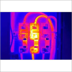
Thermography Survey Solution
Camera TypeInfrared
CertificationCertified Thermographer
FeaturesFault Detection Preventative Maintenance Increased Uptime Cost Effective Thermal Imaging Detailed Report
Image FormatDigital
Report FormatPDF
ResolutionVariable
Statistical Analysis Surveys Software Solution
AccuracyHigh
CustomizationClient-specific
Data InputSurvey data
DeliveryOn-time
FeaturesData analysis Survey results Business insights Customizable Reliable results Timely delivery
Output FormatReports charts

Service of Land Survey
AccuracyCentimeter level
ComplianceIS 14411
CoverageWide area
DeliverablesDigital maps reports
FeaturesAccurate surveys Detailed maps Fast service Competitive price
MethodologyGPS Total Station

Conventional Survey Services
AccuracySub-meter
ComplianceLocal standards
DeliverablesDigital maps
EquipmentLevel Theodolite
FeaturesAccurate surveys On-time delivery Reliable results Expert services Budget-friendly
MethodologyConventional
General Engineering Works
Bharuch
Home Survey Services
AccuracyMillimeter level
Data FormatVarious
Equipment TypeTotal Station
FeaturesAccurate surveys Reliable results Expert team Budget-friendly Efficient service
Range500m+
SoftwareSpecialized Survey
General Engineering Works
Bharuch

Conventional Surveying
Accuracy1mm
Dominant ColorYellow
FeaturesPrecise measurements Accurate data Efficient workflow Reliable results Detailed mapping
Measurement Range100m
Power SourceBattery
Product TypeSurvey Instrument
General Engineering Works
Bharuch
Conventional Surveying
Accuracy1"
Dominant ColorYellow
FeaturesPrecise measurements Accurate data Reliable results Efficient workflow Cost-effective solution
Magnification30x
MaterialPlastic/Metal
Measurement Range1000m
General Engineering Works
Bharuch

Conventional Survey Services - Aluminum Brass Level 30x Magnification 100m Range | Accurate Readings On-Time Service Reliable Results
AccuracyHigh precision
ComplianceISO 9001
FeaturesAccurate readings On-time service Reliable results Expert service
Instrument TypeLevel
Magnification30x
MaterialAluminum Brass
General Engineering Works
Bharuch
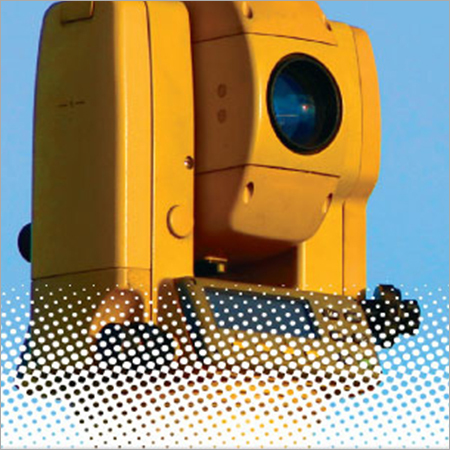
Marine Dgps Receiver For Marine Positioning And Survey Work Application: Industrial
ColorYellow
FeaturesPrecise positioning SBAS enabled NMEA output Marine survey Reliable data
ManufacturerTrimble
ModelBeacon
OutputNMEA
TypeDGPS receiver
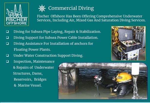
Automatic Commercial Diving Survey Service
CertificationDNV-GL
Depth Range100m
Dive Duration8 hours
EquipmentState-of-the-art
FeaturesSubsea repair Cable install Anchor install Dam inspection Bridge repair
PersonnelCertified divers
Fischer Marine And Offshore Private Limited
Navi Mumbai
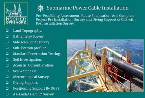
Subsea Power Cable Survey Services Application: Residential
AccuracyHigh
Cable TypesVarious
ComplianceIndustry standards
Depth RangeVariable
FeaturesPre-installation surveys Post-installation surveys Diving support Complete projects Professional service Lower charges
ReportingDetailed
Fischer Marine And Offshore Private Limited
Navi Mumbai
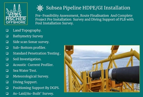
Automatic Subsea Pipeline Survey Services
AccuracyHigh
ComplianceIndustry standards
Data AnalysisAdvanced
Depth RangeVariable
FeaturesPre-installation surveys Post-installation surveys Diving assistance Risk mitigation Project success
ReportingComprehensive
Fischer Marine And Offshore Private Limited
Navi Mumbai
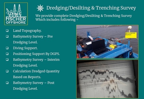
Automatic Bathymetry Survey Services For Dredging And Desilting
AccuracyHigh
ComplianceRelevant Standards
Depth RangeVariable
FeaturesDepth Mapping Dredging Support Precise Surveys Data Analysis Cost Savings Efficient Dredging Improved Safety Project Success
MethodMultibeam
ResolutionSub-meter
Fischer Marine And Offshore Private Limited
Navi Mumbai

Topographical Survey Solution
AccuracySub-cm
Coverage AreaVariable
Data DeliveryDigital
Data FormatsDXF SHP
FeaturesPrecise data Accurate maps Efficient workflow Client specific Advanced tech Future-proof data
SoftwareAutoCAD

Site Survey
AccuracyHigh Precision
DimensionsVariable Size
Dominant ColorYellow
FeaturesPrecise Measurement Data Acquisition Site Analysis Project Planning Accurate Results
MaterialsMetal Plastic
Product TypeSite Survey
Popular Categories in Bharuch
Popular Products


© 1999-2026 Infocom Network Private Limited. All rights reserved.