Remote Sensing Services - Advanced Satellite Imaging & Processing | Precision Land Use Mapping, Change Detection, Geo Referencing
Price:
Get Latest Price
In Stock
Product Specifications
| Accuracy | Sub-meter |
| Data formats | GeoTIFF, ERDAS |
| Features | Land analysis, Precise mapping, Change detection, High-resolution, Data analysis, Geo-referencing |
| Platforms | Satellite, Aerial |
| Processing | Orthorectification |
| Resolution | High |
| Sensors | Multispectral |
| Usage | Land use mapping, precision agriculture, environmental monitoring, urban planning |
Product Overview
Key Features
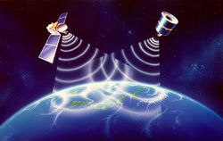
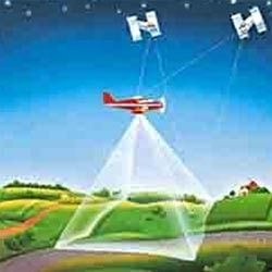
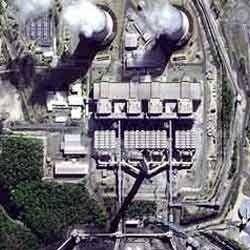
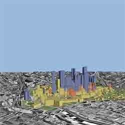
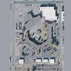
We are offering our customers an excellent quality range of Remote Sensing Services. Remote sensing is one of a suite of tools available to land managers that provides up-to-date, detailed information about land condition. Our Remote Sensing Services are widely known for its quality and durability. Remote sensing uses instruments mounted on satellites or in planes to produce images or 'scenes' of the Earth's surface.
Matrix-Geo provides following services for RS
Satellite imaging & image processing
Satellite image maps
Land use Land cover Mapping
Change detection
Geo referencing
Stereo Satellite data processing
Matrix-Geo provides following services for RS
Satellite imaging & image processing
Satellite image maps
Land use Land cover Mapping
Change detection
Geo referencing
Stereo Satellite data processing
Company Details
Established in 2008, Matrix Geo Solutions Pvt. Ltd. has made a name for itself in the list of top service providers of Others in India. Matrix Geo Solutions Pvt. Ltd. is listed in Trade India's list of verified companies offering a wide array of 3D Planimetric/Topographic Mapping Services, Digital Aero Triangulation Services, Digital Ortho Photography Service, etc. Contact here for Others in New Delhi, Delhi.
Business Type
Service Provider
Employee Count
100
Establishment
2008
Working Days
To
GST NO
07AAFCM6968F1Z4
More Products From This Seller


Seller Details
GST - 07AAFCM6968F1Z4
New Delhi, Delhi
Director
Mr. Rahul Jain
Address
47 , PKT B, SECTOR-13, DWARKA, New Delhi, Delhi, 110078, India
Report incorrect details