

Flow Code Software In Chennai
(22 products)
Microcontroller Software Grade: Food
Supported MicrocontrollersPIC AVR ARM
Communication SystemsI2C SPI USB
Supported ComponentsLEDs LCDs Sensors
Panel DesignerOn-screen design
In-circuit DebugEB006 compatible
E-blocks IntegrationTight integration
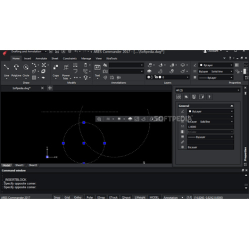
ARES Commander Auto CAD Software
System requirementsWindows 10/11
ProcessorIntel Core i5
RAM8GB
Storage10GB
GraphicsDedicated GPU
Display1920x1080

River Tools Software
Software TypeGIS Application
Primary FunctionRiver analysis
Data FormatDEM Support
Operating SystemWindows
Version3.0
License TypeCommercial
Schnell Informatics Pvt. Ltd.
Mangalwar Peth, Pune

Solid Edge Cad Software
Software TypeCAD
Version2020
License TypeSubscription
PlatformWindows
File FormatsMultiple
Usage3D modeling and design for engineering manufacturing and product design.

Autocad Software
Software TypeCAD
File FormatDWG
PlatformWindows Linux Mac
License TypePerpetual
InterfaceUser-friendly
Usage2D/3D design and drafting for architecture engineering and construction

Surfer Gis Software
Software TypeGIS
Primary FunctionMapping
Data formatsMultiple
Operating SystemWindows
License TypeCommercial
UsageGeological data analysis surface modeling and contour mapping.

Mapublisher Cartography & Gis Software
Software TypeCartography GIS
CompatibilityAdobe Illustrator
Data FormatsESRI MapInfo
Output FormatsHTML5 PDF
UsageCreate professional maps from various GIS data sources within Adobe Illustrator export to web or print formats.
License TypeCommercial

Global Mapper - Gis Software
Software TypeGIS Software
Supported Formats200+
Data AccessOnline/Local
Analysis ToolsMultiple
Operating SystemWindows/Mac
UsageGeospatial data processing mapping analysis and visualization for various applications including environmental management urban planning and resource management.

Geographic Imager Gis Software
Software TypeGIS Mapping
Primary ColorBlue
CompatibilityAdobe Photoshop
File FormatsGeoTIFF others
FunctionsEdit transform
UsageGeospatial image editing and transformation within Adobe Photoshop. Supports various raster formats map projection changes image rectification and batch processing.

River Tools Gis Software
Software TypeGIS
Primary FunctionAnalysis
Data FormatsShapefiles BIL FLT GeoTIFF
IntegrationArcView ENVI
System CompatibilityWindows Various
UsageTopographic and river network analysis for watershed management hydrological modeling and other GIS applications.

Pg-Steamer - Image Processing / Remote Sensing Software
Software TypeGIS Software
Operating SystemWindows Linux
Data FormatsGeoTIFF ERDAS
Processing SpeedVariable
User InterfaceGraphical
UsageImage processing and remote sensing data analysis for earth resources exploration and management.

Geo5 Geotechnical Engineering Software - Windows C++ Based with SQLite Database | Integrated Suite User-Friendly Interface Comprehensive Graphical Output Permanent Customer Support
Software TypeGeotechnical
PlatformWindows
ModulesMultiple
LicensingPerpetual
Language SupportMultiple
UpdatesAnnual
FAQs Related to Flow Code Software In Chennai
How many flow code software products are available in Chennai?
Where can I find flow code software nearby Chennai?
What are some related categories to flow code software in Chennai?
Can I trust the Chennai Based Flow Code Software suppliers listed on Tradeindia?
How many Chennai based Flow Code Software manufacturers are there?
What is the price range of flow code software in Chennai?
| Company Name | Currency | Product Name | Price |
|---|---|---|---|
| - | - | ARES Commander Auto CAD Software | 100 INR (Approx.) |
What is the delivery time for flow code software in Chennai?
EnviroInsite - Windows Compatible Groundwater Data Visualization Software | Python Powered PostgreSQL Database RESTful API Graphical User Interface Cloud Integration with AWS Advanced Mapping and Charting Features
Software TypeGIS Software
Operating SystemWindows Linux
Data FormatsVarious
Mapping CapabilitiesContour 3D
Analysis ToolsMultiple
UsageGroundwater data visualization and analysis for environmental projects.

Photoscan Photogrammetry Software
Software TypePhotogrammetry
Primary Function3D Modeling
Data OutputOrthophotos DEMs
WorkflowAutomated
User Skill LevelNon-specialist
PlatformDesktop PC
MAPublisher Cartography Software
Software TypeCartography
CompatibilityAdobe Illustrator
Data FormatsESRI Shapefiles
Output FormatsPDF HTML5
Map ProjectionsMultiple
UsageCreate and edit maps from GIS data within Adobe Illustrator.
Global Mapper GIS Software
Software TypeGIS Software
Operating SystemWindowsmacOSLinux
Data FormatsMultiple
License TypeSubscription
Data CapacityVariable
UsageMappinganalysisvisualizationdata management of geographic information.
Processing and Terrain Surface Modelling Software
Software TypeGIS Software
Data FormatsLAS XYZ
Processing SpeedFast Processing
Supported PlatformsWindowsLinux
Accuracycm Level
Output FormatsTIFF GeoTIFF

Pg-Steamer - Image Processing/Remote Sensing Software
Software TypeGIS Software
Primary OSWindows
Data FormatsGeoTIFF ERDAS
Processing SpeedHigh speed
InterfaceUser friendly
Memory ManagementOptimized

GEO5 Geotechnical Engineering Software - Version 5.0 Single-User License 10+ Integrated Modules Windows Compatible C# Programming SQL Server Database & Phone Support
Software TypeGeotechnical
ModulesMultiple
InterfaceUser-friendly
Operating SystemWindows
Data ImportVarious formats
UsageGeotechnical engineering tasks including slope stability foundation design and earth retaining structures analysis.
Geographic Imager Gis Softwares
Software TypeGIS Mapping
Primary ColorBlue
CompatibilityAdobe Photoshop
File FormatsGeoTIFF others
Supported OSWindows macOS
UsageGeospatial image editing and transformation within Adobe Photoshop. Supports various raster formats; enables functions like mosaicing projection transformation georeferencing and batch processing.

EnviroInsite - Groundwater Data Visualization Software | Windows Linux Mac Compatibility REST API Access Subscription Based Licensing Graphical User Interface
Software TypeGIS Application
PlatformWindows/MacOS
Data FormatsMultiple
Visualization ToolsAdvanced
LicensingSubscription
UsageGroundwater data visualization for geologists hydrogeologists and engineers
Dialog Flow Software Services
Software TypeAI Chatbot
Programming LanguageMultiple
DeploymentCloud-based
IntegrationAPI-driven
ScalabilityHigh
UsageConversational AI for human-computer interaction automating tasks enhancing customer service.
Popular Categories in Chennai
Popular Products


© 1999-2026 Infocom Network Private Limited. All rights reserved.