


Esurvey Cad
Get Latest Price

In Stock
Product Specifications
| Software Type | CAD |
| Modules | Three |
| Data Input | CSV, Excel, CAD |
| Output | Maps, reports |
| Compatibility | Windows |
| Usage | Topographical mapping, earthwork calculation, contour generation |
| License | Perpetual |
| Features | Contour generation, Earthwork calculation, Topo map creation, Data import, Fast processing, CAD integration |
Product Overview
Key Features
These ESurvey CAD comes with three Modules. Contours: To Generate smooth contours quickly from point data available in CAD drawings/Excel & CSV Files. Earthwork: To Calculate Volume & generate Sections from point data available in CAD drawings/Excel & CSV Files. Topodraw: To Generate Topographical maps from point data instantly with blocks and elevations in their respective Northing and Easting.
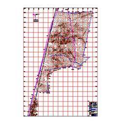
ESurvey CAD is a compact software solution using which you can generate the topographical map, Contours and Calculate Earthwork quantities for the surveyed area. It comes with three modules- Topodraw, Contours and Earthwork.
The Topodraw module comes with features like
Generating the topographical map of the surveyed area along with blocks, using the point data available in Excel or CSV file.
Importing predefined or newly defined blocks automatically while creating drawings.
The Contour module comes with features like
Importing the points data from Excel, CSV or CAD for Contour generation.
Generating Contours in E SurveyCAD interface or directly within the CAD package at the specified contour interval depending on the Boundary or Scanning Radius. Also generate the Grid Elevations or Block Levels along with contours.
The Earthwork module comes with features like
Generating Earthwork calculation with fixed formation level or between two surfaces.
Generating Earthwork calculations for complicated surfaces by importing simple lines defining the 3d surfaces.
ESurvey CAD is a compact software solution using which you can generate the topographical map, Contours and Calculate Earthwork quantities for the surveyed area. It comes with three modules- Topodraw, Contours and Earthwork.
The Topodraw module comes with features like
Generating the topographical map of the surveyed area along with blocks, using the point data available in Excel or CSV file.
Importing predefined or newly defined blocks automatically while creating drawings.
The Contour module comes with features like
Importing the points data from Excel, CSV or CAD for Contour generation.
Generating Contours in E SurveyCAD interface or directly within the CAD package at the specified contour interval depending on the Boundary or Scanning Radius. Also generate the Grid Elevations or Block Levels along with contours.
The Earthwork module comes with features like
Generating Earthwork calculation with fixed formation level or between two surfaces.
Generating Earthwork calculations for complicated surfaces by importing simple lines defining the 3d surfaces.
Company Details
E Surveying Softech (India) Pvt. Ltd., Established in 2007 at Bengaluru in Karnataka, is a leading service provider of Software Design in India. E Surveying Softech (India) Pvt. Ltd. is one of Trade India's verified and trusted names for listed services. With extensive experience in the field of Software Design, E Surveying Softech (India) Pvt. Ltd. has made a reputed name for itself in the market with satisfactory ESurvey CAD, ESurvey Lisps, Esurvey Sections, etc.
Focusing on a customer-centric approach, E Surveying Softech (India) Pvt. Ltd. has a pan-India presence and caters to a huge consumer base throughout the country. Get Software Design from E Surveying Softech (India) Pvt. Ltd. at Trade India quality-assured services.
Focusing on a customer-centric approach, E Surveying Softech (India) Pvt. Ltd. has a pan-India presence and caters to a huge consumer base throughout the country. Get Software Design from E Surveying Softech (India) Pvt. Ltd. at Trade India quality-assured services.
Business Type
Service Provider
Establishment
2007
GST NO
29AACCE7842B1ZQ
More Products From This Seller


Seller Details

GST - 29AACCE7842B1ZQ
5  Rating
RatingBengaluru, Karnataka
C.E.O.
Mr. Kotaa Krishna Kamath
Address
MR15, Pathway P-3, Nandini Layout, Bengaluru, Karnataka, 560079, India
Report incorrect details